

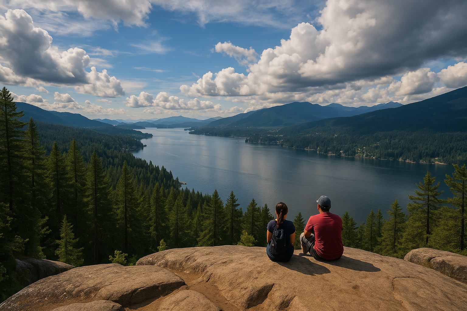
Want an easy day hike near Vancouver with great views and little effort? You’re in luck. Around Vancouver, there are lots of simple trails that take under three hours but still show off amazing scenery. You can wander to the famous quarry overlook at Deep Cove, stroll by quiet forest lakes, or climb to a mountain viewpoint. In this guide, we’ve picked seven hikes perfect for beginners, families, or anyone who wants a relaxed outdoor adventure. Each listing gives you a quick overview, key stats (distance, elevation gain, time, location, and whether it’s kid- or dog-friendly), tips on parking or transit, and a handy pro tip. Whether you have just an hour or a half-day, there’s a route here for you—think waterfalls, ocean and lake views, and lush rainforests. Since these spots can get busy, try going early or on a weekday if you want some peace and quiet. Ready to hit the trail? Lace up your boots and explore these scenic gems near Vancouver!
7 Easy Day Hikes Near Vancouver for Beginners
Quarry Rock (Deep Cove)
Trail Summary: Quarry Rock in Deep Cove is a short and very popular beginner hike that gives you a spectacular view of Indian Arm. The 3.8 km round trip follows part of the Baden Powell Trail through a coastal forest, crosses a creek on a wooden bridge, then climbs up some rocks to a large bluff. From the top of Quarry Rock, you can see the turquoise inlet below and the surrounding mountains – a great reward for such an easy hike.
Quick Stats: Distance about 3.8 km round-trip; elevation gain about 100 m; time about 1.5 hrs; location Deep Cove (North Vancouver); difficulty easy; dogs yes (off-leash, per Metro Park rules); kids yes (there is some stair climbing, so it works better for older kids).
How to Get There: It takes about 30 minutes to drive from downtown Vancouver: take Highway 1, exit at Mount Seymour Parkway, and follow signs to Deep Cove and Panorama Drive. You can park in the Deep Cove lot off Panorama Drive, with the trailhead at the far end. If you go by bus and ferry, ride the Seabus to Lonsdale Quay, catch bus #212 to Deep Cove, then walk from the last stop to Panorama Drive.
Pro Tip: The Quarry Rock parking lot fills up fast on weekends, so try to get there early, pick a weekday, or take the bus. Wear sturdy shoes, because the trail has wooden stairs and lots of tree roots. When you arrive at Quarry Rock, climb to the highest point on the rock for the best view and a bit of shade it can get really sunny in the open clearing.
Best Hiking Backpacks: Top 10 Ultimate Picks for Every Adventure
Dog Mountain (Mount Seymour)
Trail Summary: Dog Mountain is an easy but very pretty hike on the north side of Mount Seymour Provincial Park. The trail is 5 km out and back and doesn’t climb much, though you’ll pass through some muddy, root-filled forest. The payoff is awesome: from the top you can see downtown Vancouver, Burrard Inlet, Indian Arm, and on clear days even Mount Baker and the Fraser Valley. It’s perfect for beginners since it’s short and mostly steady, but watch out for slippery or muddy spots after rain or snow.
Quick Stats: Distance about 5 km round-trip; elevation gain about 34 m net; time about 2 hrs; location Mount Seymour Provincial Park near Deep Cove; difficulty easy (forest trail); dogs yes (on-leash); kids yes (older kids will handle it easily).
How to Get There: From downtown Vancouver, drive north on Highway 1 over the Second Narrows Bridge and take Exit 24 onto Mount Seymour Parkway. Follow the parkway up the mountain and watch for the BC Parks sign on the right, just past the chairlift—that’s where the parking lot and trailhead are. There’s no bus here, and it’s about a 30-minute drive.
Pro Tip: This trail is really popular in winter for snowshoeing, but it can get muddy or slippery any time. Bring hiking poles or something for extra grip (good boots help a lot) and pack layers of clothes. In summer, try to start early because it gets busy in the afternoon. Statistics from Outdoor Vancouver’s Dog Mountain guide and trail description.
Lynn Canyon Park Loop
Trail Summary: Lynn Canyon Park in North Vancouver has a famous 50-meter suspension bridge and several short loops through a mossy rainforest. A typical route is the Lynn Canyon Loop, about 2–3 km, which takes you over the bridge, down to the 30-Foot Pool, then back. It’s a pretty easy walk with stairs and boardwalks, making it great for families. Along the way you’ll see clear pools, big ferns, and tall evergreen trees. Entry is free since it’s a city park, so it’s an inexpensive adventure. Plan on about 1 to 1.5 hours for a relaxed stroll around the loop.
Quick Stats: Distance about 2.5 km; elevation gain about 80 m (mostly stairs); time about 1 to 1.5 hours; location Lynn Canyon Park in Lynn Valley, North Vancouver; difficulty easy to moderate; dogs allowed; kids allowed (lots of stairs, so watch young ones).
How to Get There: It takes about 25 minutes to drive from downtown Vancouver: cross the Ironworkers Bridge, then follow Mountain Highway and Lynn Valley Road to Peters Road, and continue to the Lynn Canyon Ecology Centre parking lot. On public transit, take the SeaBus to Lonsdale Quay, then catch bus 228 to Lynn Valley Centre, and walk along Peters Road to the park just ask the driver for the best stop.
Pro Tip: The free parking lot fills up fast on summer weekends, so try to get there early or come later in the afternoon to avoid the crowds. Bring a light jacket since the canyon can feel cool and damp under the trees, even in summer. Vancouver Tourism calls the Lynn Canyon loop a “relatively easy” 1.5-hour walk through a stunning rainforest.
Whyte Lake
Trail Summary: Whyte Lake is a hidden gem in West Vancouver reached by the Nelson Creek/Trans Canada Trail. This easy 5 km round-trip hike follows a creek through a grove of giant Western red cedar and Douglas fir. You start on a short, steep climb, then the trail levels out through a peaceful forest and over wooden bridges across Nelson Creek. After about 2 km, you arrive at a small, calm lake with a little dock perfect for lunch or a swim in summer. The whole way is shaded and scenic, making it a favorite family route.
Quick Stats: Distance about 5 km round-trip; elevation gain around 160 m; time about 2 hrs; location Caulfeild area, West Vancouver (near Horseshoe Bay); difficulty easy–moderate; dogs on-leash (allowed on most of the trail); kids yes (toddler-friendly path).
How to Get There: It takes about 30 minutes to drive from Vancouver. Cross the Lions Gate Bridge, turn onto Taylor Way, then head west on Highway 1. Take Exit 4 for Woodgreen and Capilano, then follow Westport Road. After you pass under Highway 1, turn right into the gravel lot by the gate. The trailhead is just behind the gate next to the road underpass. There’s no public transit that goes directly here.
Pro Tip: Parking is free but limited, so try to arrive early. There’s a fresh-water faucet by the gate where you can fill your bottles. The forest floor is mossy and covered in ferns, so pack bug spray in warm months. Trail stats and the scenic description come from the official trail guide.
Exploring British Columbia: A 5-Day Road Trip from Vancouver
Gold Creek Falls
Trail Summary: Gold Creek Falls is a gentle 5.5 km hike in Golden Ears Provincial Park near Alouette Lake. The trail winds through thick, mossy rainforest and opens up to two waterfall viewpoints. At the first spot, you see the creek misting as it plunges into a gorge. If you keep going for a few more minutes, you reach the top of the falls where you get a stunning view of snow-capped mountains and feel the spray on your face. It’s an easy hike with very little climbing, so beginners will love it. Just remember that on busy weekends from May to September, you need a free day-use reservation.
Quick Stats: Distance about 5.5 km round-trip; almost no climb (mostly flat); time about 2 hours; location Golden Ears Provincial Park near Maple Ridge; difficulty easy; dogs allowed on-leash near the parking lot and off-leash after the first kilometre; kids welcome.
How to Get There: It takes about 1.5 hours to drive from Vancouver. Head east on Highway 1, take Exit 44 onto the Lougheed Highway, then follow Dewdney Trunk Road to 232nd Street and continue onto Fern Avenue into Golden Ears Park. Stay on Fern past the Alouette Lake turnoffs until you reach the trailhead parking lot. If you’re visiting on a busy summer weekend, remember to reserve your free day-use pass online.
Pro Tip: Keep bear spray handy in case you run into wildlife. The trail is full of trees, so wear bright colors so you’re easy to spot. You’ll see the falls at their best in spring when the snow melts or after heavy rain. Before you start, grab a park map at the lot to follow the signs and stay on the right trail to the falls.
Burnaby Mountain Park
Trail Summary: Burnaby Mountain at SFU has lots of easy trails and parks. We suggest a 10 km loop starting at the parking lot by the Horizons restaurant. The route winds through forest and neighborhoods, giving you regular views of Burrard Inlet, Indian Arm, the city skyline, and the North Shore mountains. Even though 10 km is a bit longer than the other hikes here, the climb is gentle (about 380 m total), and you can turn back at any point. At the top, Burnaby Mountain Park has picnic spots and public art, so it’s perfect for families.
Quick Stats: Distance about 10 km loop; elevation gain about 380 m total; time about 3 hrs; location Burnaby Mountain Park in Burnaby; difficulty moderate (mostly easy trail with a few steeper parts); dogs allowed on-leash; kids welcome (playgrounds and a park at the trailheads).
How to Get There: From downtown Vancouver, drive east on Highway 1 and take Exit 37 for the Barnet Highway to SFU/Burnaby. Follow signs to Burnaby Mountain Park and park in the main lot by Horizon’s restaurant. There isn’t any public transit that goes all the way up the closest bus from the SkyTrain stops down on Barnet Highway.
Pro Tip: You can pack a picnic or grab lunch at Horizons, which has wide-view terraces. Burnaby Mountain Park has 28 km of trails, so you can tweak your route any way you like even a 3–5 km out-and-back gives great views. The park also connects to the Trans-Canada Trail, so if you have extra time, you can link up with the Diez Vistas section for even more scenery.
Twin Falls (Lynn Canyon)
Trail Summary: You can pack a picnic or grab lunch at Horizons, which has wide-view terraces. Burnaby Mountain Park has 28 km of trails, so you can tweak your route any way you like—even a 3–5 km out-and-back gives great views. The park also connects to the Trans-Canada Trail, so if you have extra time, you can link up with the Diez Vistas section for even more scenery.
Quick Stats: Distance about 1.5 km round-trip; elevation gain about 65 m; time about 1 hr; location Lynn Canyon Park (North Vancouver); difficulty easy; dogs yes (on-leash; discouraged on the bridge for safety); kids yes (with careful supervision on the stairs).
How to Get There: From Park Road in Lynn Valley, turn onto Peters Road and follow it to the Lynn Canyon Ecology Centre parking lot. Park there, then cross the suspension bridge directly from the centre to reach the Twin Falls trailhead. Transit is the same as for the Lynn Canyon Loop: SeaBus to Lonsdale Quay, then bus #228 to Lynn Valley Centre, followed by a short walk up Peters Road to the Ecology Centre.
Pro Tip: Parking free at Lynn Canyon Ecology Centre lot; arrive early or late afternoon to avoid crowds; late fall/winter quieter parking; stay on the marked trail and behind fences—strong river currents; swimming prohibited.
Bonus Beginner Hike Ideas
- Rice Lake (North Vancouver): This super-flat 3 km loop around a serene lake in Lynn Headwaters Regional Park features wheelchair-accessible boardwalks, a fishing dock, and dozens of lakeside rest stops, making it a very easy stroll ideal for babies, prams, or anyone seeking minimal effort.
- Lighthouse Park (West Vancouver): This easy 6 km loop weaves through old-growth forest along coastal trails to an oceanfront lighthouse, with well-marked paths and breathtaking views of the Salish Sea and Vancouver skyline perfect for families.
- Bowen Lookout (West Vancouver): This short 4.5 km hike in Cypress Provincial Park climbs steadily to a brief but steep final section, rewarding you with sweeping panoramas of Bowen Island and Howe Sound. It’s entirely manageable for beginners who can handle a quick climb, making it a perfect half-day summit adventure.
FAQ
Are these hikes really beginner-friendly?
All of these hikes land in the easy or easy-moderate category well-maintained, few technical challenges, and most under 6 km making them perfect for families and beginners. From the “relatively easy” Lynn Canyon Loop to the famously gentle Rice Lake circuit, you’ll get great views without overexerting yourself. Still, come prepared: carry water, lace up good shoes, and build in a few breaks.
Do I need any permits or passes?
Most of these hikes like Quarry Rock, Lynn Canyon, and Burnaby Mountain are on public parkland with no fee. Golden Ears Provincial Park, however, requires a free day-use reservation on busy summer weekends, so if you’re planning Gold Creek Falls between mid-May and Labour Day, book at least two days in advance on the BC Parks website.
Can I take my dog on these trails?
That’s right—nearly every trail we’ve covered allows dogs on-leash, but always double-check each park’s rules. Mount Seymour, for example, is strictly leash-only, while Golden Ears lets pups off-leash after the first kilometre. Even on leash, keep Fido close at cliff-edges and on Lynn Canyon’s suspension bridge it really does wobble!
If you’re craving a true off-leash romp, consider the designated dog area at Capilano River Regional Park or the Seymour Demonstration Forest’s trails. And don’t forget water bowls, waste bags, and a little extra TLC on hot days.
How should I prepare for these hikes?
Absolutely no matter how gentle the trail, pack your 10 Essentials (water, snacks, extra layers, headlamp, first-aid kit, map/compass or GPS, firestarter, knife, sun protection, and emergency shelter). Always check local trail and weather reports Avalanche Canada in winter, Metro Vancouver’s park sites in summer and let someone know your route and expected return time. Follow Leave No Trace: stay on marked paths, carry out all garbage, and respect wildlife. Ready to tailor a lightweight kit for your next outing?
Wrap Up
I’m thrilled this roundup sparks your hiking itch those ocean vistas and mossy forests really are big rewards for little effort. Which trail are you most excited to tackle first? And if you’re craving more adventure, tell me your dream view seaside, alpine peak, or hidden waterfall and I’ll chart your next perfect Vancouver outing.